EN
EN  PT
PT ES
ES FR
FR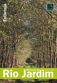
Percurso do Rio Jardim
The Rio Jardim route starts and ends on the track parallel to the west railway line, which connects Esteiro de Canelas to Salreu. Along its 2 km in a "U" shape, the visitor will be able to enjoy beautiful landscapes and habitats, as well as enjoy the extensive shady area provided by the dense tree vegetation on the banks of the Rio Jardim.
Salreu
Estarreja
Description
* Distance to cover: About 2 Km
* Journey duration: Approximately one hour
* Scope of the route: Environmental, landscape, cultural
* Degree of difficulty: Easy (no unevenness)
* Recommended season: All year
* GPS coordinates: [GPS 40º43’26 ’’ N | 8º33’52’’W]
Source: https://www.cm-estarreja.pt/